Showing posts with label US Forest Service. Show all posts

Thursday, September 29, 2011

Code of the campfire #10

The code of the campfire says put the fire dead out when you break camp. The U.S. Forest Service campfire permit requires that you use the "drown, stir and feel" technique to extinguish the campfire. Any method that leaves burning embers -- even those buried under a layer of dirt -- can spark a wildland fire.

To drown the campfire, pour several pails of water over the campfire. I find that it takes five or more gallons of water to drown the fire. With a shovel, thoroughly mix the ash and water until it resembles a soupy mess. Feel the ashes to make sure the fire is dead out. Walk the ground within a fifty-foot radius to make sure no embers have escaped.

The second part of the code says consider your neighbor. Watch the prevailing wind as you pour water onto the hot fire. This way you'll avoid showering your neighbor (or wife for that matter!) with an ash cloud.

Friday, September 16, 2011

Code of the campfire #7

The code of the campfire says clear all debris on the forest floor away from the campfire. The U.S. Forest Service says the camper should rake a "minimum of five feet in all directions" from the fire. Like a fire break, the clearing creates a buffer zone between the fire and surrounding forest. The break will give the cook the chance to extinguish hot embers should any escape.

I rake all leaves, needles and kindling away from the campfire ring with a small bamboo rake. It's small size conveniently fits inside the storage compartment of the tent trailer. The rake is a key component in my collection of campfire tools.

Yes, there's a follow up to this rule as well. Be curious. Leave the circle around the campfire cleaner than you found it. This rule has been a key component of my personal lifelong code. Always leave a clean campsite.

Monday, September 12, 2011

Code of the campfire #6

The code of the campfire says tool up. The U.S. Forest Service campfire permit says that you "must have a shovel available at the campfire site for preparing and extinguishing campfires." In addition to a shovel, I find that a grill or campfire grate, 18-inch utility tongs and small leaf rake all contribute to successful campfire.

The grill holds pots and skillets over the fire, especially where the Forest Service doesn't provide one. (It seems when I leave the fire grate at home the campground doesn't supply one!) The tongs efficiently arrange burning coals around in the fire. And with the rake, you don't have to use your boot to clear a five-foot area around the campfire.

The second part of the code says leave the campfire site cleaner than you found it. Pick up trash, rake debris from around the fire pit and see that the fire is dead out.

Tuesday, September 06, 2011

Code of the campfire #4

The code of the campfire says you need a source of firewood. While you can haul seasoned firewood to the campsite, the time honored way to gather wood is to drive the forest roads.

Only pick up "down and dead" fuel for the campfire, per the U.S. Forest Service. Cutting standing trees, living or dead, is forbidden. Check local regulations before cutting or gathering wood.

As I said yesterday, the second part of the code says share. Help the novice camper light a campfire. And share firewood with a late arriving party.

Sent from my Samsung Captivate(tm) on AT&T

Friday, June 08, 2007

Noon Meal at Greensburg

Emergency responders pick up sack lunches at the tornado base camp in Greensburg, Kansas. Two hot meals are typically served to emergency responders working forest fires and similar incidents. An enhanced sack lunch is passed out for the noon meal.

Under the 2007 national mobile food services contract, caterers are required to provide the following menu items in each sack lunch:
  • Meat sandwich or vegetarian substitute

  • A second entree, such as a pizza pocket or burrito

  • Fresh fruit or dried fruit package -- dried fruit can only be served once in three days

  • Packaged cookies, brownie or granola bar

  • Two canned fruit juices totaling 11 ounces

  • Packaged snack, such as candy, trail mix, fresh vegetables, pretzels, jerky, shelled nuts or dried/cured meats and cheeses

  • Appropriate condiments

  • Two paper napkins and pre-moistened towelettes
This is a pretty hefty meal that's been formulated for emergency response workers, like wildland firefighters, who exert large amounts of energy on the job. The contractors are required to serve variety, which can be difficult when you consider the limited supply of non-perishable items that can be placed in a sack lunch.

Typically the crews pick up there lunches from a central point after breakfast. Each responder carries his lunch in a day pack until released for lunch. Except for crews located a spike camp, breakfast and dinner are served from the catering trailer in camp.

Photo credit: Mike Ferris of the U.S. Forest Service.

Monday, May 21, 2007

Greensburg, Kansas Tornado Assistance Base Camp Facts

GREENSBURG, KAS. (May 21, 2007) -- The Boise Incident Management Team continues to manage a base camp in Greensburg, Kansas providing emergency responders with hot meals, temporary housing, laundry service, and hot showers. The Base Camp, located in Davis Park, was established on May 8 with help from the San Juan Hotshots from Durango, CO.

The Hotshots assisted the IMT with: removing numerous fallen trees and tornado debris blown into the park; setting up sleeping tents; and mitigating any identified safety hazards within and around the base camp facility. They were released earlier this week, but their efforts were invaluable in getting the Base Camp established. The Base Camp has become very popular with emergency responders, giving them a place to rest and break away from the hectic and stressful environment they are working in.

The Boise IMT will continue to operate the camp over the next few weeks and provide responders with quality logistical support to maintain health and strength to accomplish the response mission for the community and people of Greensburg, Kansas.

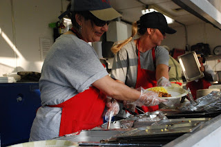
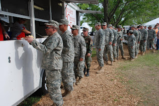
Photograph captions: Catering is provided by Incident Catering Service of Snohomish, Wash. To the left, Kansas National Guard is waiting in the chow line at base camp. (Photo credit: Mike Ferris of the U.S. Forest Service.)

CAMP FACTS AS OF MAY 21, 2007

  • Incident Management Team Personnel Includes (these personnel are running the base camp):
    Incident Commander
    Deputy Incident Commander
    Safety Officer
    Public Information Officer
    Planning Section Chief
    Logistics Section Chief (Base Camp Managers, Ground Support, Communications, Supply, Security, & Food Units)
    Finance Section Chief (Equip Time Recorder & Costs)
    2 Camp Crews (20 total)
  • Catering unit: 1 - Capacity to feed up to 1,200 people
  • Shower unit: 1 - Contains 18 shower stalls
  • Sleeping tents: 40 - Each sleeps up to 8 people
  • Housing provided: Sleeping average 269 responders from 36 agencies per night
  • Laundry service: Local laundry service provided daily
  • Meals provided: 15,737 - breakfasts, lunches and dinners
  • Cost to date: $936,000
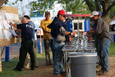
Emergency responders washing up before dinner at Davis Park Base Camp.
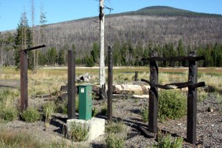
Sunday, March 25, 2007

Crown of the Peavine Ridge Forest

This impressive stand of conifers guards the southern entrance to the Crystal Basin in Eldorado National Forest. Ice House Road marks the lower end of the grove. This stand is one of many survived the Cleveland Fire along the southern slope of Peavine Ridge. Here's what the U.S Forest Service had to say about these survivors:
Within the fire perimeter, a few areas of large trees survived the conflagration and the living trees stand in stark contrast with their surroundings. Activities that began some 13 years previous had made the difference. In 1979, about 150 acres near the Cleveland Corral Information Station had been prescribed burned with repeat burning in 1981. A 30 acre stand of trees was prescribed burned for a third time in the Spring prior to the Cleveland Fire. Amazingly, when the 100 foot tall flames burning in the crowns of the neighboring trees approached this stand, without the buildup of dead woody material on the ground, the flames dropped to the ground and left the larger trees alive (via ElDoradoCounty.net).
The fire grew from a humble five-foot diameter fire when reported to a crown fire that danced along the tree tops withing minutes on September 29, 1992. The fire claimed the lives of two pilots. It wouldn't be declared controlled until October 14 and burned 22,485 acres along U.S. Highway 50 in the vicinity of Riverton.

Monday, March 05, 2007

Alder Ridge Lookout, Part II

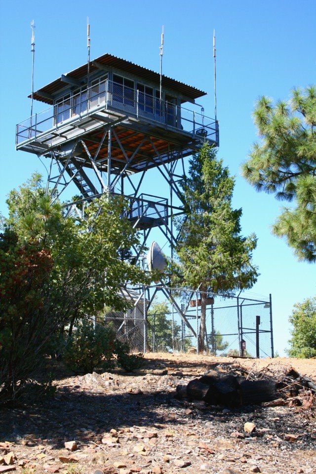
Internal conflict between desiring solitude and craving the company of others has plagued me since childhood. Give me a good book at a noisy party, and I'll homestead the couch. I may be drawn into an occasional conversation. But, in the end, the book will win.

That's why Alder Ridge Lookout appeals. The well-groomed grounds of the lookout gives me the chance to read and write in notebook in solitude. I haven't seen anyone else at the lookout my four or five trips to the top.

I'd love to see the Forest Service establish a cabin rental at Alder Ridge like the one at Robbs Hut (PDF file), about 15 or 20 miles north. Family and a few friends would provide conversation and fellowship. And there are plenty of nearby rocks when solitude needed.

This is the residence at Alder Ridge Lookout in Eldorado National Forest from the lookout cab. The lookout sits a top a plateau at the highest point on Alder Ridge. The ridge stands guard over the confluence of Alder Creek (above in the photo) and South Fork of the American River. The lookout was built by the Civilian Conservation Corps in 1936.

Friday, March 02, 2007

Lessons in Digital Photography

By the time I returned to the truck last President's Day, I realized that I had shot over 100 digital pictures of Alder Ridge Lookout in ISO 1600.

In the past, I've taught myself to watch the different exposure settings and to make sure I framed the picture to my liking. This day I forgot to change the ISO back to 100 or 200 after shooting low-light pictures the night before.

I've developed a mental checklist that I run through each time I get the camera out of my daypack. And I've shot several hundred test pictures so I can test the result as I learn to adjust aperture, shutter speed, ISO, etc. Normally, I reset each setting to a default to avoid problems like this one.

ALDER RIDGE LOOKOUT

This 60-foot Aermotor lookout tower was built by the Civilian Conservation Corps in 1936. Situated at 6,687 feet above sea level, the tower overlooks the South Fork of the American River. A 2004 U.S Forest Service Passport in Time project was planned to restore the cabin for use a rental.

The single-car garage and residence were painted within the past two or three years. To this point, the lookout has not been offered for rent by the Forest Service.

Tuesday, September 19, 2006

No Visitors Here

After viewing mop up of the Ralston Fire from Nevada Point Ridge in northern Eldorado National Forest Saturday, my son and I stopped by Bald Mountain Lookout. The lookout, one of three with the same name in California, is located about eight miles east of Georgetown.

My intention was to view the fire area from the lookout tower and visit with the attendant. Instead, I found a 10-foot chain-link fence guarding the steps up into the Coppola.

Unlike many western lookouts, Bald Mountain is closed to the public. The attendant never ventured out onto the cat walk to greet us. He (or she?) kept busy monitoring the radio and watching for fires.

Bald Mountain is one of several active lookouts in Eldorado National Forest. The current tower is the fourth one to occupy the site.

Big Hill Lookout is the most prominent. Perched a top the 6132-foot mountain, the tower sits in full view of Union Valley Reservoir. It was rebuilt after the 1992 Cleveland Fire destroyed the 1935-era tower.

Tuesday, August 15, 2006

West Davis Lake Campground

An Osprey circles above
the lake shore in search
of prey in the warm
afternoon sun.
We camped at West Davis Lake Campground for three days in July 1990. The camp, located along the west shore of Odell Creek as it enters the lake, was situated in a nice stand of lodgepole pines.

Today, the campground is closed. The Davis Fire destroyed the campground in 2003. The area since has been converted to day use. The boat ramp is still in use.

According the the website for the Deschutes National Forest, the campground was supposed to reopen in 2005.

The 21,000-acre fire destroyed much of the lodgepole pine forest that surrounds Davis Lake. The fire started somewhere near the East Davis Lake Campground, visible in the stand of live pine trees in the background. Investigators believe the fire was of human origin.


Lupine flowers grow in the meadow along Odell Creek, near the boat ramp.